AUSTRALIAN EARTHQUAKES
2008-2024
Earthquakes Around Australia
Australia isn't usually associated with seismic activity, but it has experienced significant earthquakes that have impacted its landscape and communities. Experts warn that long periods without major quakes may lead to complacency [1]. In September 2024, seismologists introduced the term "earthquake swarms" after over 30 seismic events hit the Hunter region of New South Wales. While swarms are natural, some human activities, like mining, could induce them. Experts are particularly concerned about building designs and locations for critical infrastructure, such as nuclear power plants.
One of Australia's most serious earthquakes struck Newcastle, NSW in 1989, measuring 5.6 on the Richter scale [2]. The impact included:
- 13 fatalities: 9 at the Newcastle Workers Club, 3 on Beaumont Street, and 1 from shock
- 160 people hospitalized
- 50,000 buildings damaged (about 40,000 homes)
- 300 buildings demolished
- 300,000 people affected, with 1,000 left homeless
- Estimated damages of around $4 billion
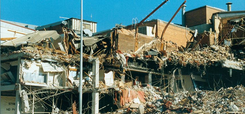
The Newcastle, NSW 1989 Earthquake [2].
Earthquake Effects by Magnitude and Depth
Earthquake magnitude and depth are crucial factors that significantly influence the level of damage caused by a seismic event. The magnitude of an earthquake, measured on the Richter scale or the moment magnitude scale, quantifies the energy released at the earthquake's source. Generally, higher magnitude earthquakes release more energy, resulting in greater potential for destruction. Fortunately, Australia has never experienced an earthquake of Magntiude higher than 6.4. However, the depth at which an earthquake occurs also plays a vital role in determining its impact. Shallow earthquakes, typically occurring at depths less than 70 kilometers, tend to cause more intense shaking and damage at the surface because the seismic waves have less distance to travel. In contrast, deeper earthquakes, occurring at greater depths, may dissipate their energy before reaching the surface, leading to less noticeable effects. Therefore, a magnitude 6.0 earthquake that strikes at a depth of 10 kilometers can cause far more damage than a magnitude 6.5 earthquake occurring at a depth of 100 kilometers.
| Magnitude | Earthquake Effects | Estimated Number Each Year |
|---|---|---|
| 2.5 or less | Usually not felt, but can be recorded by seismograph. | Millions |
| 2.5 to 5.4 | Often felt, but only causes minor damage. | 500,000 |
| 5.5 to 6.0 | Slight damage to buildings and other structures. | 350 |
| 6.1 to 6.9 | May cause a lot of damage in very populated areas. | 100 |
| 7.0 to 7.9 | Major earthquake. Serious damage. | 10-15 |
| 8.0 or greater | Great earthquake. Can totally destroy communities near the epicenter. | One every year or two |
Earthquake Magnitude Guide. [3].
Dangers of Earthquakes Per State
Each state in Australia faces unique risks associated with earthquakes, but the level of susceptibility varies considerably. Historically, data reveals that Western Australia has experienced the highest number of seismic events, followed by South Australia and New South Wales. However, it's essential to consider the geographical context - Western Australia spans an area 11 times larger than Victoria, which skews the perception of its earthquake activity [4]. Surprisingly, despite being the second-largest state, Queensland ranks among the lowest for seismic occurrences. This discrepancy can largely be attributed to the complex nature of tectonic activity and fault lines.
Earthquakes result from sudden movements along faults-fractures in the Earth's crust where tectonic plates interact. These movements are driven by the immense pressure that builds up over time as plates shift. Tectonic plates are massive sections of the Earth's crust that float on the semi-fluid mantle beneath them. These plates constantly move, albeit very slowly, due to convection currents in the mantle. The worst recorded earthquake occurred in 1960 near Valdivia, Chile, measuring a staggering 9.5 on the moment magnitude scale. Earthquakes are common in Chile due to it being placed near the South American Tectonic Plate boarders.
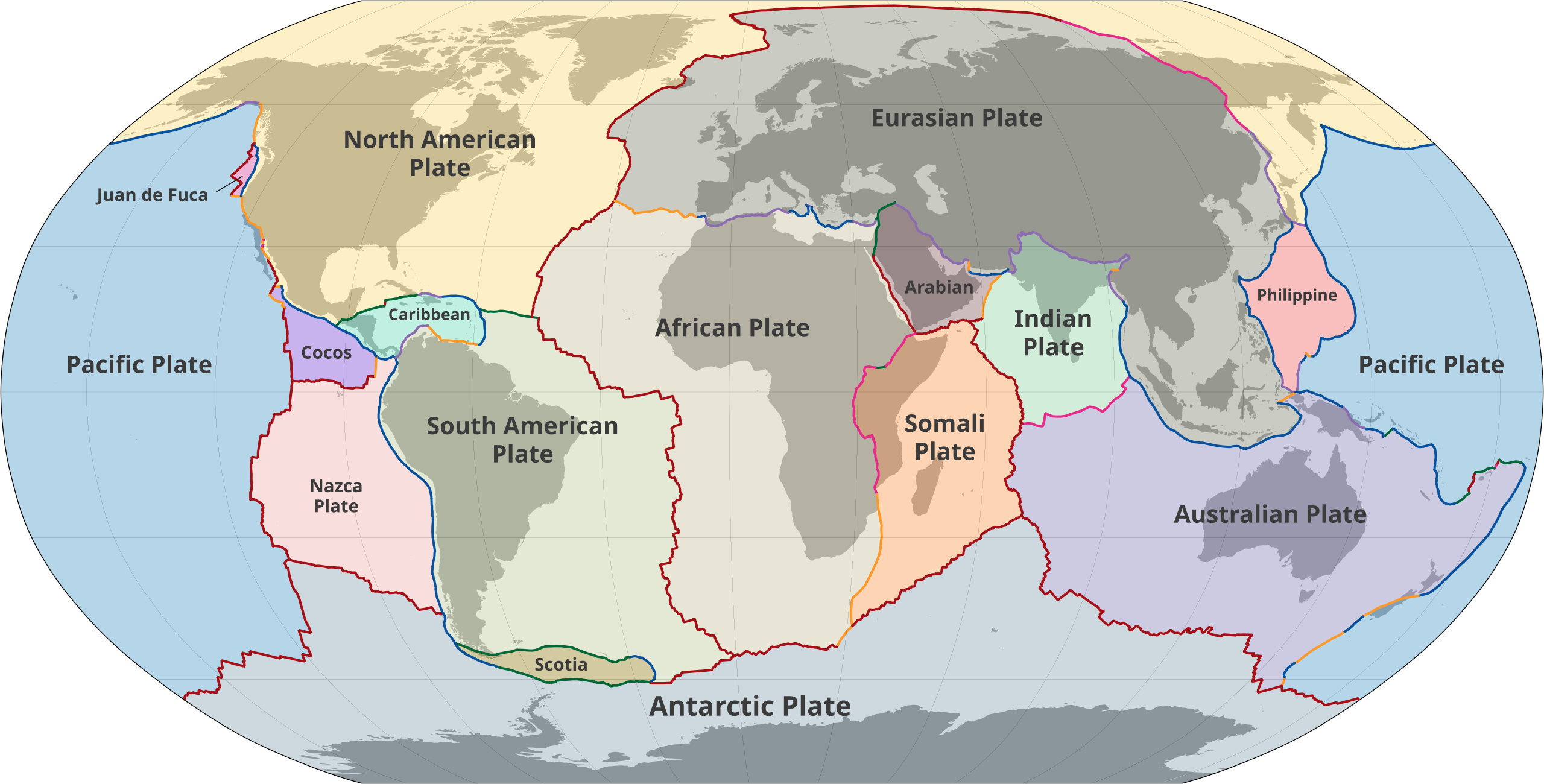
World Map of the Tectonic Plates [5].
States like Victoria, and New South Wales, located near more active tectonic boundaries, are at greater risk due to the presence of several significant fault lines, such as the Napier and Tarrabool faults. Conversely, while Western Australia has experienced many earthquakes, much of its seismic activity occurs in sparsely populated areas, resulting in less damage and fewer reported impacts. Understanding these dynamics is crucial for assessing earthquake risks and implementing effective preparedness strategies tailored to each state's unique geological landscape. When considering the area of the two different states, it becomes more apparent that Victoria on average does experience more earthquakes per area than Western Australia as can be seen in the population pyramid to the right. Additionally, the southern states typically experience more number of earthquakes, as can be seen in the bubble plot below with a lot of the nothern states data lying near the x-axis.